| Sat | 9am – 5pm |
| Sun | 10am – 5pm |
| Mon | 9am – 5:30pm |
| Tue | 9am – 5:30pm |
| Wed | 9am – 5:30pm |
| Thu | 9am – 5:30pm |
| Fri | 9am – 7pm |
Ask our staff anything about our shop or products, or share your feedback.

PublishedHema Maps, September 2018 |
ISBN9781925195163 |
FormatSheet Map / Folded, 1 pages |
Dimensions100cm × 70cm |
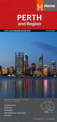
A map that has the Perth suburbs (1:80,000) and Perth city (1:15,000) maps on one side and the Perth region (1:750,000) and Fremantle (1:20,000) maps on the other. Included is a rail network map of Perth as well as points of interest and accommodation for both Fremantle and Perth.

