| Mon | 9am – 5:30pm |
| Tue | 9am – 5:30pm |
| Wed | 9am – 5:30pm |
| Thu | 9am – 5:30pm |
| Fri | 9am – 5:30pm |
| Sat | 10am – 5pm |
| Sun | 12pm – 4pm |
Ask our staff anything about our shop or products, or share your feedback.
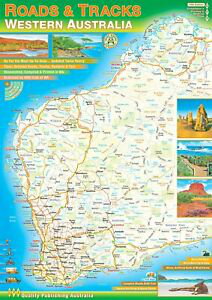
This spiral-bound A4 atlas of the state covers all on & off road tracks in detail. Coverage of 1:250,000 across the south west and 1:1,000,000 across the rest. The road detail shows major highways all the way down to unsealed roads, old tracks, 4WD only routes and walking trails.
Intermediate road distances are shown on nearly every road. Useful and interesting places are shown including various attractions, fuel stops, accommodation, campsites, rest stops, national parks and fishing spots. Researched, compiled and printed in WA, produced using the latest mapping data.


